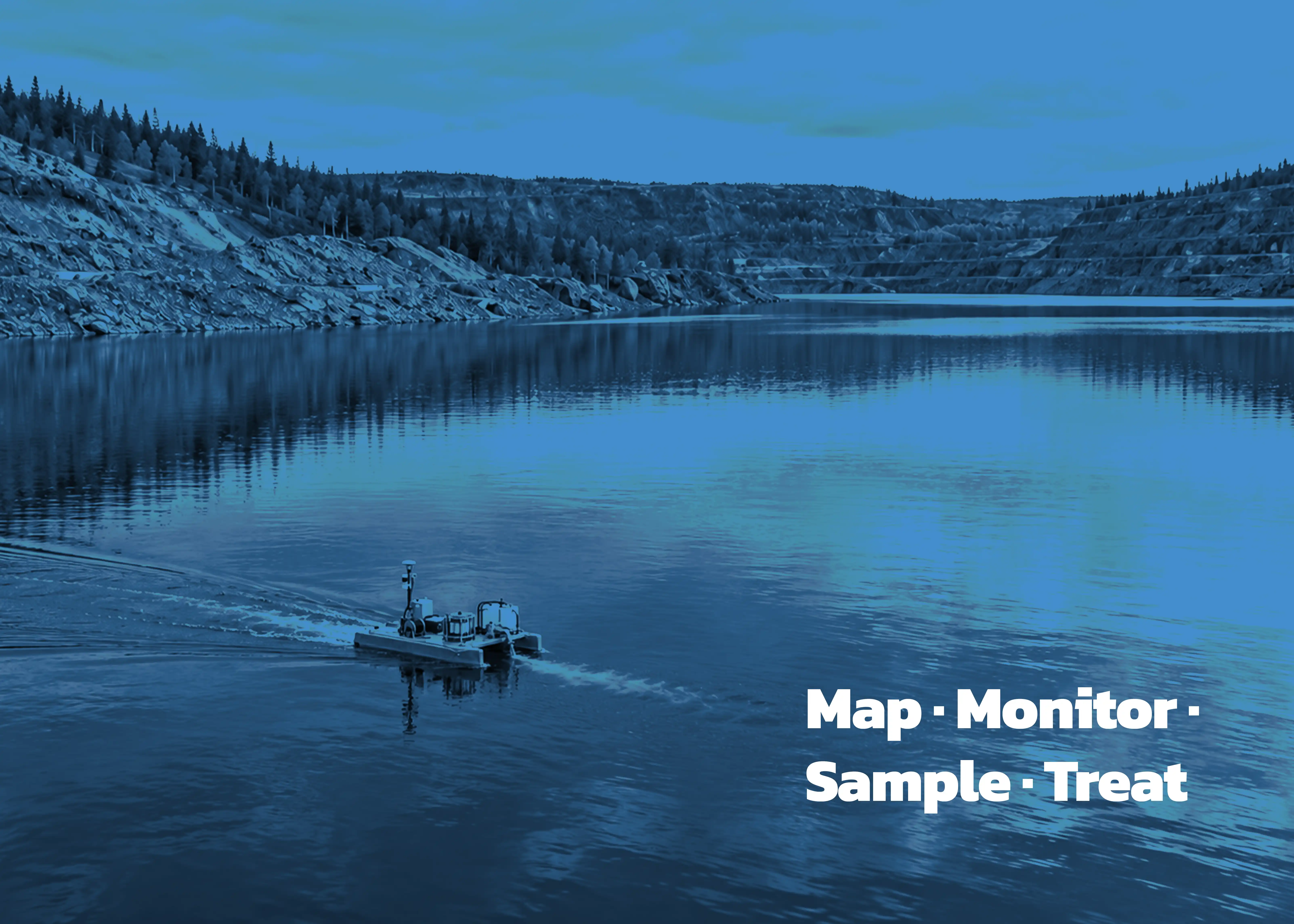
"PMAP's unmanned vessels can map a basin's bathymetry, monitor water quality, collect depth-specific samples, and inject treatment reagent in one coordinated field campaign. Linking all four to one spatial record makes before-and-after treatment results easier to interpret."
An autonomous boat is easy to mistake for a labour-saving device. In mine-water management, its more consequential role is epistemic: it can connect what a water body looks like, what its chemistry is doing, where a sample came from, and where treatment was delivered.
Those facts are often gathered in separate campaigns. A depth model may describe one day, laboratory samples another, and treatment records a third. PMAP's unmanned vessels are designed to narrow those gaps. In one coordinated field campaign, a configured vessel can survey a basin, profile water quality, retrieve samples, and dispense reagent. The point is not four gadgets on a hull. It is a continuous record from observation to intervention.
A field campaign, not a magic button
The mission begins before launch. Survey lines, sampling coordinates and depths, sensor parameters, treatment objectives, quality-control procedures, and operating limits must be defined first. PMAP's treatment methodology similarly starts with hydrographic and water-quality data, then uses an engineering plan to determine reagent needs and injection locations.
That order matters. Authoritative field-sampling guidance still requires calibration, representative collection, preservation, documentation, and QA/QC. Autonomy can execute a defensible protocol with unusual consistency; it cannot rescue a weak one.
Four jobs, one spatial record
Mapping establishes the geometry. Along planned transects, hydrographic instruments pair position with depth to build a bathymetric model. PMAP uses this model to estimate basin shape, depth, volume, and sediment distribution. The map is not decoration: it gives every subsequent sensor reading, sample, and injection point a physical context. Autonomous navigation, environmental sensing, and multibeam bathymetry have also been demonstrated together in a peer-reviewed lake-survey system.
Monitoring captures the moving system. PMAP's monitoring platform can measure pH, turbidity, conductivity, dissolved oxygen, and temperature across locations and depths. These measurements reveal gradients that a shoreline reading may miss. They also matter because some properties change after collection and are best measured in situ. Yet a sensor profile is not a complete chemical analysis; it is a fast, spatially resolved view of conditions.
Sampling anchors the interpretation. A smart winch can lower sampling equipment at programmed GPS positions and depths, while PMAP's multi-sampler can hold as many as 24 samples. Depth-specific collection is scientifically important because pit lakes and ponds can be stratified. British Columbia's lake-monitoring protocol, for example, pairs vertical sensor profiles with chemistry samples from different depth zones. Automation improves repeatability, but containers, blanks, duplicates, preservation, and chain of custody remain essential. The USGS field manual treats measurement, collection, processing, and laboratory analysis as connected but distinct steps.
Treatment turns observation into action. PMAP prepares reagent as a slurry and uses its S.M.A.R.T. vessel to inject it at designated locations. The company's closed-loop description is straightforward: collect data before and after injection, then use the new information to guide dosing. A 2024 PMAP technical abstract describes the pond as virtual reaction columns whose geometry and chemistry inform reagent quantity and placement. The operational logic is measure, act, verify, adjust.
The real gain is coherence
Combining the four jobs changes the value of the data. The bathymetric model supplies volume and depth. Sensors identify patterns worth investigating. Laboratory samples test what the sensors cannot. Treatment coordinates can then be compared with before-and-after measurements along repeatable routes.
This does not prove that every change was caused by treatment; hydrology, mixing, weather, and analytical uncertainty still matter. It does, however, create a stronger basis for inference than four disconnected records. The vessel becomes a mobile experimental platform, not merely a remote-controlled workboat.
One boat is useful shorthand
"One boat, four jobs" describes a mission architecture, not a universal payload operating all functions at once. PMAP's fleet is differentiated: S.M.A.R.T. combines monitoring, bathymetry, and dosing; P.R.O.B.E. emphasizes water-quality measurement and digital mapping; S.P.O.R.T. supports pilot studies and validation. PMAP describes sampling at the unmanned-platform level, so the exact hull, instruments, and sequence must be selected for the site, permit, weather, and study design.
That qualification makes the concept more credible, not less. A sound autonomous deployment uses only the functions the decision requires, while preserving the relationship among them. The scientific advance is continuity: the same spatial framework links what was mapped, what was measured, what was collected, and what was done.
For sites considering autonomous monitoring or in-situ treatment, the first question should not be which boat to buy. It should be: what decision must this deployment support? PMAP can help define the answer.