The environmental record of an abandoned mine is not limited by analytical chemistry. It is limited by how hard the site is to reach.
There is an uncomfortable gap at the centre of legacy mine water management. Our ability to characterize a water body in the lab has improved by orders of magnitude over the past three decades. Our ability to get an instrument onto that water body has not.
The result is a regulatory record built mostly from sites that happen to be accessible. A national survey in 2000 counted roughly 10,000 abandoned mines on file in Canada. Only about 60% had been inspected in the field, and most had little or no chemical or physical stability testing.
In the United States, mining has degraded streams in more than 40% of western watersheds, often at sites with no identifiable responsible party and no road. Natural Resources Canada notes that its national records are compiled from jurisdictions with different data standards and update schedules. These are not small gaps. They are the shape of the evidence base.
Access as the limiting reagent
What sets sampling frequency at a remote pit lake? Not the residence time of the water. Not the kinetics of sulphide oxidation. Not, strictly, the reporting requirement.
It is the cost of a helicopter charter, the availability of a two-person boat crew, the short season when the surface is neither frozen nor unsafe, and the lab turnaround that follows.
Under those constraints, quarterly grab samples from a few shoreline points are a rational operational choice. As a sampling design, they are close to the worst case.
Mine-impacted water bodies are often stratified, both chemically and thermally. A surface grab from the edge does not represent a stratified pond. Treating it as if it does carries error into every later decision: load estimates, treatment sizing, closure planning and liability provisioning.
This is a spatial and temporal aliasing problem, and it is well understood in principle. What has been missing is an affordable way to sample densely enough to avoid it, at sites where sending people is expensive, slow and hazardous.
What an autonomous platform actually changes
The value of an unmanned surface vessel is not novelty. It is that it separates sampling density from crew cost.
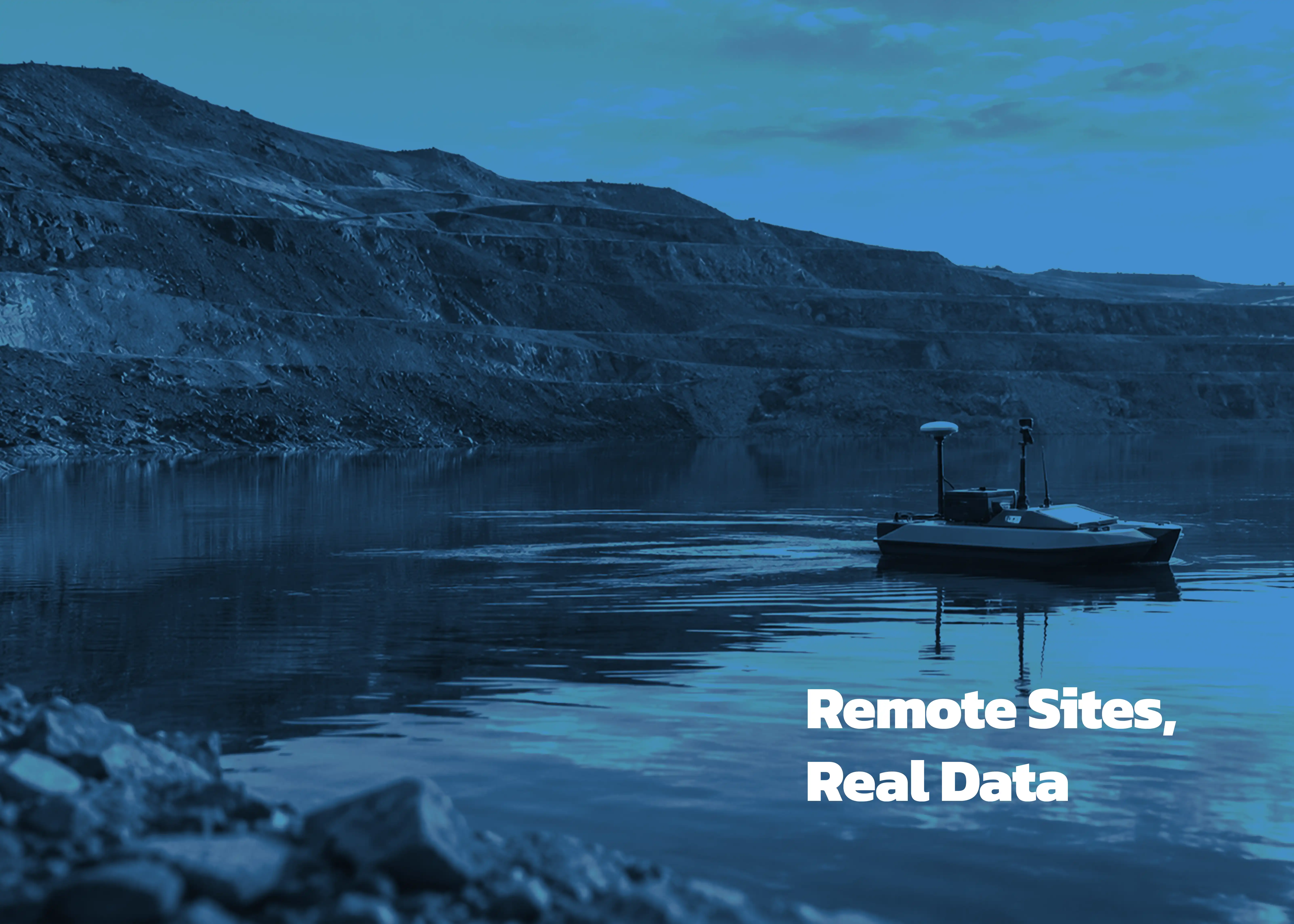
PMAP's monitoring vessel, P.R.O.B.E. (Point Reaching Operational Bathymetric Explorer), navigates on its own using onboard algorithms. It measures 30 or more water quality parameters while running a bathymetric survey at the same time, producing a three-dimensional digital twin of the water body.
Its size, 44 × 36 × 15 inches, matters more than it looks. A platform that small is far easier to mobilize than a crewed survey boat. A smaller unit, S.P.O.R.T. (26 × 16 × 14 inches), handles pilot and proof-of-concept work at sites that are not yet characterized.
Three things follow:
- Denser coverage. Transects can be run closely enough to resolve spatial differences rather than averaging over them.
- Full water column profiles. pH, turbidity, conductivity, dissolved oxygen and temperature can be measured at set depth intervals, which is where stratified systems actually differ.
- Repeatable surveys. A programmed route can be run again exactly. Comparing one campaign with the next no longer depends on an operator returning to roughly the same spot.
PMAP also uses unmanned sediment corers and traps for bottom sampling, and deep water sampling for full vertical characterization. These procedures are difficult, hazardous and inconsistent when done by hand.
From observation to treatment
The second platform in the fleet, S.M.A.R.T. (Surveying, Mapping, Analysing and Reagent Transmission), takes the same approach from measurement to treatment. It follows a workflow of bathymetric survey, treatment planning, slurry preparation and in-situ injection, delivering reagent at planned points in the water body.
The difference is in infrastructure, not chemistry. Conventional treatment forces a remote site to stop being remote: a pad is built, power is run, a plant is installed and staffed, and the capital is committed before the site is fully characterized.
In-situ dosing from a mobile autonomous platform reverses that order. Characterize first, treat from the same vessel, and build nothing permanent.
What autonomous survey doesn't replace
Autonomous survey does not replace laboratory confirmation. Multiparameter sondes drift, so any credible program keeps calibration protocols, duplicate samples and independent lab verification.
Ice cover and seasonal access still limit the operating window at northern sites. Anyone evaluating an autonomous platform should also ask about endurance, power supply, and how data is transmitted from sites without connectivity. These are fair questions, and the right answers depend on the site.
None of this weakens the case. It sharpens it. The argument for autonomous platforms at legacy sites does not depend on the vessels being remarkable. It rests on a simple observation: when the cost of a measurement falls, the number of measurements rises. The resulting dataset describes the water body, not the road leading to it.
Thousands of legacy sites, many never tested, and no realistic prospect of building infrastructure at most of them. The instruments will have to go to the water, because the water is not coming to us.
Planning monitoring at a remote site?
If you manage a pit lake, tailings pond or legacy site that is hard to reach, PMAP can scope a pilot survey with S.P.O.R.T. or a full characterization with P.R.O.B.E. We are happy to talk through endurance, power and data transfer for your specific site.
Contact PMAP to discuss your site →