For decades, the volumes, depths and sediment profiles of mine water ponds and tailings impoundments were estimated — derived from original design drawings, occasional cross-sections and operator experience. That approach was defensible when remediation meant "pump and treat indefinitely." It is no longer defensible. Post-Brumadinho regulation, the Global Industry Standard on Tailings Management (GISTM), tighter discharge limits, and the rise of in-situ treatment have all raised the bar on quantitative site characterisation. High-resolution bathymetric surveys delivered from autonomous surface vessels (ASVs) have become the foundational dataset on which credible remediation plans are now built — and the case for vessels over alternative platforms is stronger than it might initially appear.
What vessel-based survey delivers
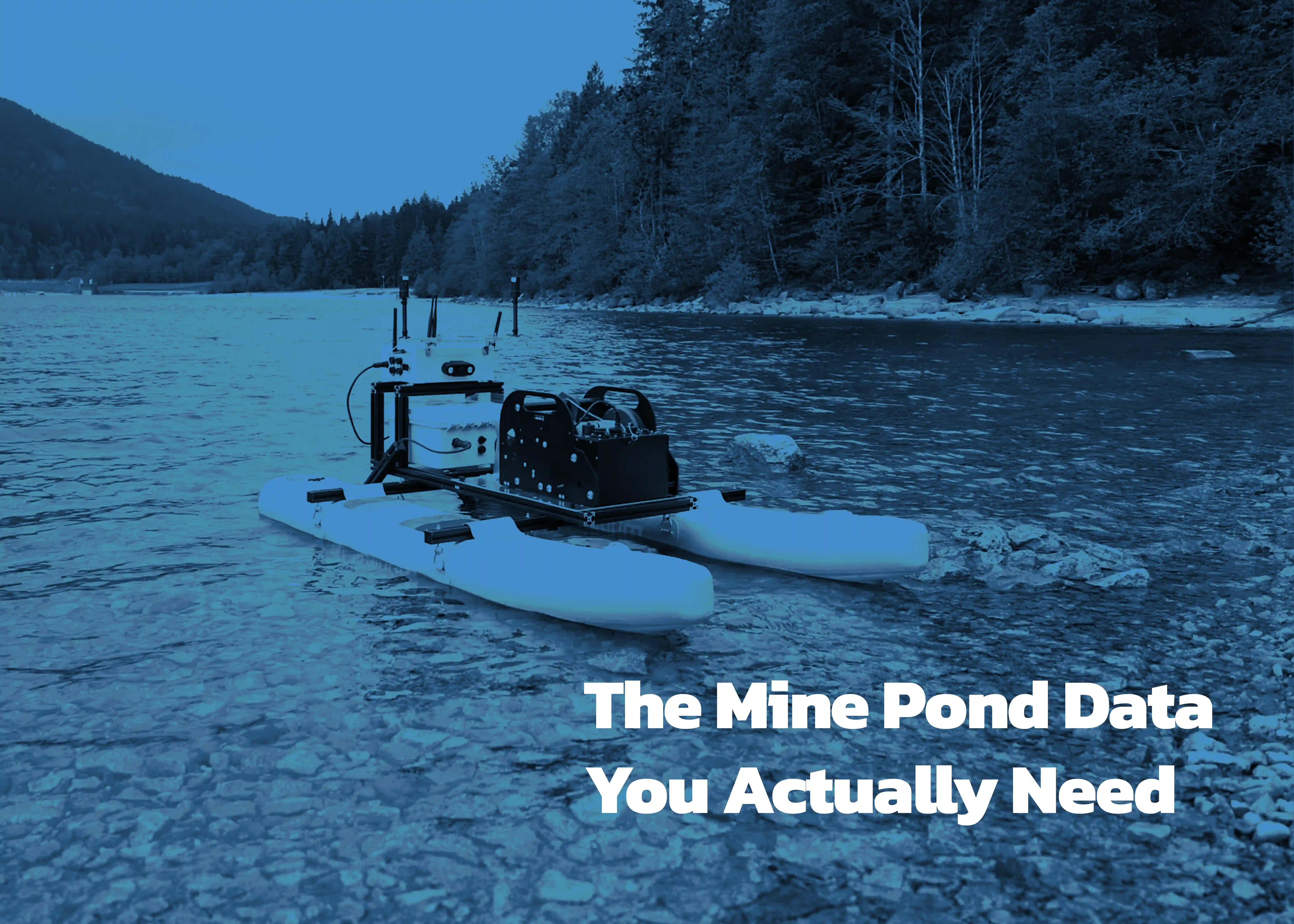
Single-beam echo sounders (SBES) mounted on remotely operated vessels such as the Teledyne OceanScience Z-Boat deliver depth accuracies of a few centimetres via RTK GPS and can be piloted from shore across dams exceeding 1.5 km — removing operators from caustic, acidic or unstable supernatant ponds entirely. Multibeam echo sounders (MBES) extend this to dense, gap-free swath coverage, routinely gridded to 1 m or finer, with backscatter intensity providing substrate characterisation particularly useful in pit lakes where bedrock benches and soft sediment coexist. Sub-bottom profilers, deployed alongside these systems, convert depth maps into sediment-volume maps by imaging discrete stratigraphic layers beneath the pond floor.
The critical advantage of vessel-based platforms, however, extends well beyond geometry. An ASV equipped with modular payloads can simultaneously collect bathymetric data, water quality parameters — pH, conductivity, dissolved oxygen, turbidity, temperature — and hydrodynamic measurements such as current velocity profiles via acoustic Doppler current profilers (ADCPs). The result is not merely a depth map but a true digital twin of the pond: a spatially referenced, three-dimensional model integrating physical structure, water chemistry distribution and flow behaviour in a single field campaign. This integrated dataset is what underpins credible in-situ treatment design, pit lake stratification modelling and reagent-dosing optimisation. No other survey platform delivers it in one pass.
Why drones fall short
Drone-borne bathymetric LiDAR offers genuine capability at the land-water transition on tailings beaches and decant structures, and drone-mounted echo sounders have been demonstrated at facilities where launching even a small vessel is impractical. These remain niche applications, however, and the limitations are consequential.
Operationally, drones acquire data only along the flight path, carry limited payload, and cannot host the suite of water-quality sensors that transforms a geometric survey into a full site characterisation. A drone measures depth; a vessel simultaneously measures what is in the water, how it is moving, and where the chemistry changes with depth. For turbid or chemically complex tailings supernatant — precisely the conditions most common in mine pond environments — drone-borne optical LiDAR performs poorly, while acoustic systems on vessels operate without constraint.
The regulatory and safety picture adds further friction. Drone operations in many jurisdictions require specific permits, licensed remote pilots, airspace notifications and, at some mine sites, aviation safety cases that can take weeks to resolve. Insurance requirements for drone operations over hazardous infrastructure are increasingly onerous. A remotely operated surface vessel, by contrast, is typically classified as a piece of survey equipment: no airspace clearance, no pilot licence, and no requirement to notify aviation authorities. The operational mobilisation is correspondingly faster and lower-cost, and the safety case simpler to make to site management and regulators.
Where volume errors propagate
Mine-water treatment is fundamentally a chemistry problem scaled by volume. Whether the operator is liming an acidic pit lake, dosing ferric coagulant for metals removal, or adding organic carbon to drive sulphate-reducing biology, reagent demand is a direct function of the volume being treated. Errors in that term propagate with mechanical fidelity into errors in the reagent budget. A 17% underestimate of pit volume produces an equivalent shortfall in alkalinity, incomplete metal precipitation and missed discharge limits. A comparable overestimate drives excess sludge production — lime treatment in Canada alone generates over 6.7 million m³ of sludge annually at below 5% solids — accelerated consumption of tailings storage capacity, and unnecessary chemical expenditure.
The consequences of misplaced infrastructure are equally instructive. Decant towers, pump intakes and mixing barges placed without current depth data are routinely found, post-construction, to occupy depositional zones, short-circuit flow paths or slopes that fail under load. For dredging and in-situ capping, the survey defines everything: cut volumes, footprint extent, cap thickness by cell, and the baseline against which post-construction monitoring is referenced.
Regulatory context and the audit trail
GISTM's requirements on monitoring and integrated knowledge effectively demand defensible, repeatable, current data on stored volume, water cover and freeboard. National regulators in Peru, Brazil, Australia, Canada and the United States require periodic capacity and volume reporting for tailings facilities and remediation sites. Consent decrees such as the 2002 Berkeley Pit agreement set stage-elevation triggers that are meaningless without an accurate volume model behind them. Throughout, "survey-grade" is the discriminating term: recreational sonar and consumer GPS do not produce auditable records, and neither does any platform that cannot demonstrate RTK GNSS positioning, calibrated transducers, sound-velocity profiling and documented QA cross-lines.
The practical implication
A vessel-based survey, executed in a single field campaign, can correct stage–storage estimates by tens of percent, redirect tonnes of lime and coagulant, retarget dredging footprints, and position treatment infrastructure where it will function across the project life. Critically, it simultaneously captures the water quality and hydrodynamic data needed to build a living digital twin of the facility — something no aerial platform can replicate. It removes survey crews from hazardous water, satisfies regulatory audit requirements, and generates the evidence base against which every subsequent year of monitoring can be compared. The estimate era is over. The technology to replace it is already in routine industrial use, and the platform of choice — for capability, regulatory simplicity and operational flexibility — is the autonomous surface vessel.